≡ Menu
Home
Useful Links Page
Nature
The Route
Nature Reserves
Wildlife Information
Spotter Guides
Wildlife Reports
Classification Systems
Arachnid
Spiders (Araneae)
Birds (Aves)
Aquatic Birds
Birds of Prey
Cormorants
Grebes
Heron & Egret
Perching Birds
Waders & Gulls
Insect
True Fly (Diptera)
Flora Gallery
Nature Gallery
Raptor Slide Show
Cormorant Slide Show
History
The Route
Railway History
1815-1850
1850-1867
1865 – 1872
1872 – 1923
1923 – 1948
1948 – 1963
1963 – to date
Billy Preserved
Places
The Branch
Engine sheds
Havant
Langstone
Train Ferry
The Bridges
North Hayling
Hayling Station
Engines
Contractor’s
Sharp Stewart
Kitson
Stroudley Terrier
Industry
Gas Works
Oysters
Tourism
Transport
Water Supply
Social History
Railway Employees
Significant People
Memories
World War 2
Invasion Defence
Air Defence
Q Decoy Sites
Mulberry Harbour
Model Railway
History Gallery
Activities
The Route
Interpretation Panels
Bridges & Signal
The Oyster beds
North Hayling Halt
World War II
Hayling Station
Cycling
Places to Visit
Riding
Theatre
Walking
Windsurfing
Activities Gallery
Schools
Butterfly Data Sheets
Project Blog
Project Start
Path Improvement
Signal Restoration
Volunteer
About Us
Organisation Chart
Sitemap
Login
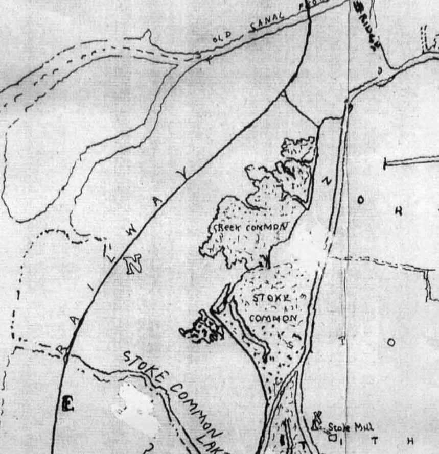
Oysterbed area, extract from 1864 Hayling Island Map
Search haylingbillyheritage.org
Tags
Driver
Fireman
Francis Fuller
Fredrick Furniss
Hayling Gas Company
Hayling Station Changes
health benefit
Health beneift
Horse races
LBSCR Engine
map
Mixed Train
Oysterbeds
Preservation
Railway incident
Railwaymen
school
South of England Oyster Company
Stroudley A1/A1x
Terrier
Train ferry
Recent Posts
Signal Opening Event
Motor Train Working on the Hayling Branch – Ralph Cousins
643 Gypsyhill at Langstone early 1900s – Richard Barton
Terriers at Fratton Shed early 1900’s – Richard Barton
The proposed Conveyor Bridge